Scouting and Mapping Drones

Scouting and Mapping Drones

Scouting & Mapping Drones

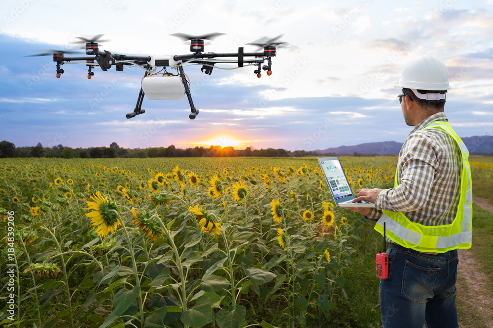
Our Scouting & Mapping Drone Solutions are built around a clear principle: data alone has no value unless it drives better decisions in the field. While many agricultural drone providers focus on capturing imagery, our approach shaped by best practices across leading UK drone service providers delivers a complete, outcome-driven solution that connects data capture, analysis, and action.

Across the market, leading providers emphasise high-resolution mapping, NDVI analysis, and early issue detection as core benefits. Services typically highlight the ability to identify crop stress, disease, and variability earlier than traditional scouting, enabling more proactive farm
management.

We build on this foundation but go further.

Using advanced drone platforms equipped with multispectral and RGB sensors, we capture precise, repeatable field data that reveals crop health, growth variability, soil performance, and environmental stress factors. Like the most advanced operators in the market, we generate outputs such as vegetation index maps, orthomosaics, and 3D field models. But critically, we focus on what happens next.

Rather than delivering raw maps, we translate insights into clear, practical recommendations. This includes prescription maps for variable rate application, targeted intervention zones, and season-long performance tracking aligning with the industry shift toward actionable intelligence and precision input optimisation .

Our solution is structured around a proven workflow seen across leading providers planning, data capture, analysis, and recommendation but enhanced with a stronger commercial focus on outcomes. From early crop establishment through to pre-harvest optimisation, we help you:

Detect issues earlier and act faster
Reduce input waste through targeted application
Improve crop uniformity and yield consistency
Make evidence-based decisions with confidence

Unlike traditional scouting which can be time-intensive and limited in scope, drone mapping enables whole-field visibility in hours, rather than days, transforming how quickly data becomes usable insight.

Most importantly, our Scouting & Mapping solution is designed to integrate seamlessly with your existing operations. It complements agronomy expertise, existing machinery, and farm management platforms ensuring that drone data enhances, rather than complicates, your decision-making process.

The result is a shift from reactive to proactive farming: a more precise, efficient, and commercially resilient operation driven by better information at the right time.

Scouting Drone

Multispectral Aerial Surveying

Overview

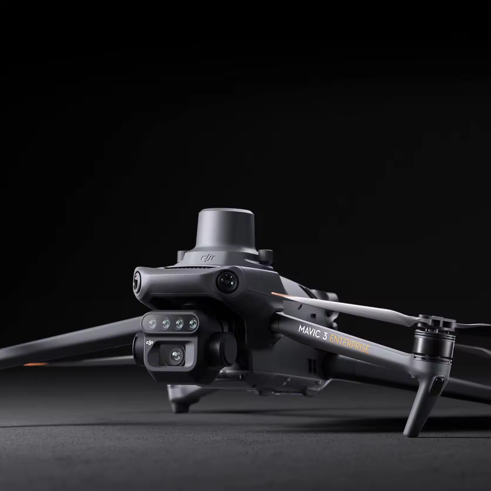
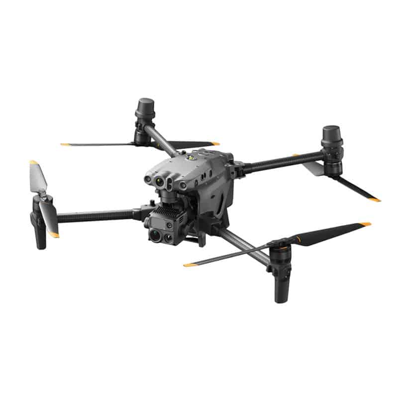
The Scouting Drone is a lightweight multispectral survey drone engineered specifically for precision agriculture, crop analysis, and environmental monitoring. Combining RGB and multispectral imaging systems within a highly portable platform, it enables rapid collection of detailed aerial data for field scouting, crop health assessment, and precision application planning.

Designed for ease of operation and efficient field coverage, the platform allows operators to capture high-accuracy agricultural data with minimal setup time while benefiting from its advanced flight automation, terrain following, and RTK-enabled positioning systems.

The scouting drone  helps improve input targeting, reduce waste, enhance crop monitoring, and support more sustainable farm management practices.

Key Benefits

Integrated multispectral and RGB imaging for advanced crop analysis
High-precision RTK positioning for accurate aerial mapping
Compact and highly portable folding design
Fast deployment for efficient field scouting operations
Supports NDVI and other vegetation index analysis workflows
Optimised for precision agriculture and environmental monitoring
Seamless integration with all the leading mapping platforms

Specifications (Key)

Camera system: 20MP RGB camera + 4 × 5MP multispectral sensors
Spectral bands: Green, Red, Red Edge, Near Infrared (NIR)
Positioning: Centimetre-level RTK positioning support
Flight time: up to approx. 43 minutes
Coverage efficiency: up to approx. 200 hectares per flight
Obstacle sensing: Omnidirectional obstacle avoidance
Data capture: RGB, multispectral, NDVI and vegetation index mapping
Platform type: Compact foldable agricultural survey drone
Ecosystem compatibility: Pix4DFields, Agfemo and precision agriculture workflows

Matrice 400

Equipped with the MicaSense Altum-PT
Multispectral Aerial Surveying

Overview

The Matrice 400 is equipped with the MicaSense multi spectrum camera representing a highly advanced aerial intelligence platform engineered for precision agriculture, environmental analysis, and large-scale geospatial data acquisition. Rather than functioning as a conventional drone system, this combination delivers a powerful modular ecosystem capable of capturing synchronised high resolution RGB, thermal, and multispectral data within a single integrated workflow. Combining long-endurance flight capability with integrated RGB, thermal, and multispectral imaging, the system enables the rapid capture of highly accurate environmental and agronomic data. Engineered for demanding operational environments, the platform supports automated flight missions, centimetre-level positioning, and scalable enterprise workflows, making it ideal for large area surveying and repeatable data collection tasks.

Key Benefits

Simultaneous RGB, thermal, and multispectral data capture
Ideal for precision agriculture and environmental analysis
High endurance platform for large-scale survey operations
Advanced thermal imaging for crop stress and irrigation analysis
RTK-enabled precision mapping and georeferencing
Modular enterprise platform supporting advanced payload integration
Automated mission planning for repeatable data acquisition

Specifications (Key)

Drone platform: Matrice 400 enterprise UAV
Payload: MicaSense multispectral and thermal sensor
Sensor capability: RGB + thermal + multispectral imaging
Spectral bands: Blue, Green, Red, Red Edge, Near Infrared (NIR), Thermal
Positioning: RTK centimetre-level accuracy
Flight endurance: extended enterprise flight duration (payload dependent)
Mission capability: Automated mapping and survey operations
Applications: Precision agriculture, environmental monitoring, research, vegetation analysis
Integration: Compatible with advanced GIS, photogrammetry, and analytics workflows

Shopping Cart

No products in the cart.