


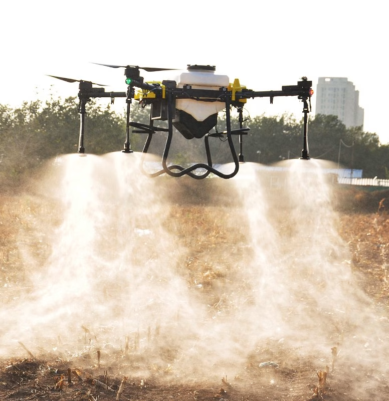
Why drone-based establishment checks are becoming essential for UK farming
For generations, crop establishment has been judged through experience, instinct, and field walking. Farmers have traditionally relied on visual assessments, digging plants, counting emergence by hand, and making educated assumptions about variability across a field. While these methods remain valuable, they are increasingly under pressure from the realities of modern UK farming: larger acreages, tighter margins, labour shortages, volatile weather patterns, and rising pressure to improve both productivity and sustainability.
Drone-based establishment checks are rapidly emerging as one of the most valuable precision agriculture
tools available to UK growers because they solve a critical challenge: understanding exactly how a crop has established across every hectare of a field, early enough to take corrective action. By combining high-resolution aerial imagery, GPS positioning, and advanced analytics, drones provide growers with a detailed understanding of emergence, plant population, drilling performance, and establishment
variability. Instead of relying on isolated sample points collected during field walks, farmers gain a complete field-wide assessment within hours. Increasingly, that speed and visibility are translating directly into better agronomic decisions, lower input waste, and stronger yields.
According to Scotland’s Farm Advisory Service, drones equipped with RGB, near-infrared (NIR), and multispectral sensors can rapidly perform stand counts and identify areas where crops have failed to establish properly, enabling growers to make faster and more accurate replanting decisions.
This matters because establishment remains one of the most important drivers of final crop performance.
Poor emergence rarely corrects itself later in the season. Uneven plant populations reduce competitiveness against weeds, compromise nutrient efficiency, increase disease susceptibility, and ultimately lower yield potential. In high-cost cropping systems, even relatively modest establishment failures can have major financial consequences.
For UK arable businesses facing rising seed, fertiliser, fuel, and machinery costs, the economics are increasingly unforgiving. Modern winter wheat seed costs can exceed £120–£160 per hectare depending on variety and treatment, while oilseed rape establishment failures have become particularly costly due to flea beetle pressure and increasingly unpredictable autumn conditions. Missing establishment issues early can result in growers carrying compromised crops through an entire season with little opportunity to recover lost potential
Drone-based establishment checks fundamentally improve the speed, accuracy, and consistency of diagnosis. Rather than spending hours walking representative areas, growers can survey entire fields in minutes. High-resolution imagery identifies thin patches, drilling misses, waterlogging damage, slug pressure, compaction zones, and delayed emergence patterns that are often difficult to fully appreciate from ground level alone.
One of the greatest advantages lies in the ability to identify variability at an exceptionally fine scale. Even highly experienced agronomists inevitably sample only a fraction of a field during traditional inspections. Drone imagery provides continuous spatial coverage, enabling growers to pinpoint exactly where problems occur, how severe they are, and how extensive the affected area may be.
This level of visibility is particularly valuable within UK farming systems, where field variability can be significant due to changing soil types, drainage conditions, historic tramlines, cultivation practices, and weather exposure. Following heavy autumn rainfall, for example, drones can rapidly identify areas affected by standing water or soil capping before symptoms become fully visible from the ground. Equally, after dry drilling conditions, emergence variability linked to moisture availability can be mapped accurately across the field.
The result is more targeted and economically informed decision-making. Instead of relying on blanket assumptions, growers can assess whether poor areas justify patch re-drilling, whether populations remain commercially viable, or whether later-season management strategies should be adjusted. In some situations, drone-derived imagery may also support crop insurance assessments or provide documented evidence of establishment failure.
The time-saving benefit is equally important. Labour availability remains a persistent challenge across UK agriculture, and establishment checks traditionally consume significant agronomy time during already pressured seasonal windows. Drones dramatically reduce this operational burden. Large areas can be surveyed quickly and repeatedly, creating a scalable


Why drone-based establishment checks are becoming essential for UK Farming
The time-saving benefit is equally important. Labour availability remains a persistent challenge across
UK agriculture, and establishment checks traditionally consume significant agronomy time during already pressured seasonal windows. Drones dramatically reduce this operational burden. Large areas can be surveyed quickly and repeatedly, creating a scalable monitoring process that becomes increasingly valuable as farm sizes expand. Industry experience consistently highlights these efficiency gains. Agricultural drone surveys can substantially reduce manual crop-walking requirements while enabling much faster identification of establishment issues and crop stress.
Another major advantage lies in the consistency and quality of the data collected. Human observation inevitably varies depending on weather, timing, fatigue, visibility, and sampling location. Drone flights, by contrast, follow repeatable GPS-guided flight paths that generate highly consistent imagery over time. This allows growers to compare establishment performance across seasons, varieties, drilling dates, cultivation systems, and soil conditions with far greater accuracy.
As highlighted by CPM Magazine, one of the greatest strengths of drone technology is its ability to provide repeatable assessments from identical locations throughout the growing season, enabling much more reliable analysis of crop development over time. That historical comparison capability is becoming increasingly valuable as farms seek to optimise cultivation systems and reduce establishment risk. Across multiple seasons, drone imagery can help identify recurring problem zones linked to compaction, drainage limitations, soil structure issues, or machinery traffic patterns. These insights support long-term strategic improvements rather than purely reactive management. Importantly, drone-based establishment checks extend far beyond standard visual imagery.
Modern multispectral sensors can detect subtle differences in plant vigour long before they become visible to the naked eye. Vegetation indices such as NDVI and NDRE provide deeper insights into biomass, chlorophyll activity, and early crop stress.
This enables growers to identify establishment concerns before they become agronomically severe.
In practical terms, that early-warning capability can influence a wide range of management decisions. Variable emergence may indicate inconsistent drilling depth, poor seed-to-soil contact, nutrient deficiency, slug activity, or developing drainage problems. Identifying these patterns early gives growers an opportunity to adjust nutrition plans, cultivation strategies, or future drilling approaches before yield penalties escalate. The technology also aligns closely with wider structural changes occurring across UK agriculture.
Increasing environmental scrutiny, pressure to reduce input use, and the expansion of precision farming systems are all driving demand for better field-level intelligence. Drone-based establishment checks contribute directly to this transition toward evidence-led management. For example, accurate establishment mapping supports more efficient variable-rate applications later in the season. Areas with weaker plant populations may require different nitrogen strategies or adjusted fungicide investment, while stronger establishment zones can be managed more intensively to maximise yield potential. Agricultural drone providers report that drone-generated prescription maps can reduce fertiliser and pesticide use by approximately 15–20% through more targeted applications.
There are important environmental advantages as well. Traditional field inspections often involve repeated machinery movement around fields during sensitive conditions. Drone operations minimise soil disturbance and reduce unnecessary traffic. More importantly, improved establishment intelligence helps optimise input use, lowering the risk of over-application and reducing diffuse pollution.
For UK farmers participating in Sustainable Farming Incentive (SFI) schemes or broader environmental programmes, the ability to generate accurate digital evidence is becoming increasingly valuable. High-resolution aerial imagery can provide documented proof of crop establishment, cover cropping, and field-condition monitoring that may support compliance and reporting requirements.


The economics of drone adoption are also improving rapidly. Advances in battery technology, sensor quality, software automation, and cloud-based analytics have significantly reduced operational barriers. Services that were once considered specialist are becoming commercially viable for mainstream UK arable and mixed farms.
High-resolution systems such as the M3 Multispectral are now widely used by UK agricultural drone providers to deliver detailed crop mapping and establishment analysis at farm scale. At the same time, the broader precision agriculture ecosystem is evolving around drone-generated data. Integration with farm management software, RTK GPS systems, autonomous machinery, and variable-rate technology means establishment checks increasingly form part of a connected digital workflow rather than a standalone service.
Projects such as the UK’s “Hands Free Hectare” initiative demonstrated how autonomous systems, drones, and precision mapping technologies can improve drilling accuracy and reduce operational inefficiencies in cereal production. The project achieved a reduction in drilling misses from 2.82% to 0.35% through improved automation and precision guidance. Ultimately, the growing importance of drone-based establishment checks reflects a wider transformation within UK agriculture. Farming is moving away from assumption-based management toward measurable, high-resolution intelligence. Growers are increasingly expected to make faster decisions with greater precision while simultaneously reducing costs, mitigating risk, and improving environmental performance.
Drone technology does not replace agronomic expertise or practical farming knowledge. Rather, it enhances them by providing a level of visibility, consistency, and analytical depth that was previously impossible to achieve economically at scale.
For UK farmers facing tighter margins, unpredictable weather patterns, and increasing pressure to improve efficiency, that visibility is no longer simply an emerging innovation. It is rapidly becoming a competitive necessity.
FarmingByDrone are the leading UK provider of Agricultural drones and drone based agricultural contract services talk to us about how we can help you. FarmingByDrone is the UK’s leading providers of agricultural drones and drone-based contract farming services. Talk to us today about how we can help you achieve better insights, stronger yields, and more consistent returns.